Drilling is where optimism receives an invoice.
In mineral exploration, maps can look promising, models can look elegant, and geophysical anomalies can glow like destiny on a consultant’s slide deck. Then the drill rig arrives. A few expensive holes later, the anomaly turns out not to be an economic mineral system, the team moves to the next target, and everyone quietly files the failed interpretation under “learning.” Very scientific. Very costly.
Jef Caers’ paper, The Future of AI in Critical Mineral Exploration, is useful because it does not treat AI as a shinier map-making machine.1 It treats AI as an enabler of a stricter scientific method for exploration: generate multiple geological hypotheses, translate them into quantitative models, test whether data can falsify them, update uncertainty, and choose the next data acquisition step based on decision value.
That sounds philosophical because it is. It also sounds operational because it is that too. The paper’s central argument is not “let the machine find the mine.” It is closer to: stop pretending one deterministic subsurface model is a business plan.
The real bottleneck is not prediction; it is false confidence
Critical minerals are now politically fashionable, financially attractive, and physically inconvenient. The energy transition needs copper, nickel, cobalt, rare earth elements, and other inputs at scale. The easy deposits, especially those visible at or near the surface, have largely been found. Exploration increasingly moves “under cover,” where geologists must infer buried systems indirectly from geophysics, geochemistry, field work, and drilling.
The conventional workflow is tidy. Acquire geophysical data. Run deterministic inversion. Interpret a 3D property model. Draw a plausible geological feature. Drill where the model says the feature should be.
The weakness is equally tidy: the workflow compresses uncertainty into one favored story.
Caers’ critique begins with determinism. In many current exploration workflows, a single inversion result becomes a single geological interpretation, which then becomes the basis for expensive drilling. The model does not merely support a decision; it socially hardens into “the deposit geometry.” After enough meetings, a hypothesis starts wearing the costume of data.
That is dangerous because the subsurface is rarely observed directly. Geophysical signals are indirect. Geological interpretations are underdetermined. Multiple geological scenarios can match the same measurements. A deterministic inversion may be visually persuasive while hiding the fact that many other plausible models fit the data just as well.
The business consequence is brutal: false positives. A false positive is not just a wrong map. It is wasted drilling, misallocated capital, delayed discovery, and sometimes a financing narrative that survives longer than the geology does.
Bayes changes the question from “what is the model?” to “which models remain plausible?”
The paper’s first mechanism is Bayesian reasoning. In ordinary exploration practice, uncertainty is often treated as a temporary embarrassment: something that will disappear if experts work harder. Caers argues that this is backwards. Uncertainty is not a failure of expertise; it is the object that exploration must manage.
Bayesian reasoning forces exploration teams to state what they believed before new data arrived. That prior belief may include geological concepts, petrophysical ranges, spatial correlation assumptions, known analogues, and uncertainty about model parameters. New observations then update those beliefs.
The basic logic is familiar:
The practical difference is not the formula. It is the discipline of making prior assumptions explicit.
In the paper’s electromagnetic survey example, the traditional approach first inverts the data and then interprets geological shapes from the resulting property model. Caers argues that Bayesian inversion should instead require plausible geological solutions to be stated before inversion. In other words, the geological imagination enters the model honestly, not through vague regularization terms and then again through interpretation. Double-dipping geological intuition and calling it objectivity is not a method. It is paperwork with better graphics.
The paper’s Figure 2 is best read as main illustrative evidence for this mechanism. It contrasts a deterministic inversion with multiple stochastic inversions that can match the same data. The point is not that one stochastic image is “the answer.” The point is that several different geometries, shapes, and orientations can remain plausible under the same observational constraints. That is exactly the information a decision-maker needs before approving the next drilling step.
| Exploration step | Deterministic habit | Popper-Bayes replacement | Business meaning |
|---|---|---|---|
| Subsurface model | One interpreted model | Multiple plausible hypotheses | Prevents one attractive story from dominating capital allocation |
| Inversion | Fit data into one property field | Sample model space consistent with data and priors | Reveals ambiguity hidden by smooth images |
| Geological interpretation | Added after inversion | Built into the prior hypothesis space | Makes expert assumptions auditable |
| Drilling decision | Hit the expected target | Reduce uncertainty or falsify hypotheses | Turns drilling into information acquisition, not treasure hunting |
The shift is subtle but important. AI does not make exploration less geological. It makes geology more explicit.
Popper supplies the missing cruelty: try to kill your favorite hypothesis
Bayesian reasoning has an obvious weakness: priors can be subjective. In exploration, that subjectivity is unavoidable because teams always bring geological assumptions into interpretation. The choice is not between “subjective” and “objective.” The choice is between stated assumptions and hidden assumptions.
This is where Popper enters the paper. Caers uses falsification to discipline Bayesian reasoning. A geological hypothesis should not merely explain the data that made it attractive. It should state what future observation would reject it.
This matters because exploration teams are vulnerable to confirmation behavior. Once a promising model exists, every new dataset can be interpreted as support. A weak anomaly becomes “consistent with alteration.” A partial intercept becomes “encouraging.” A failed hole becomes “a vectoring opportunity.” The vocabulary changes; the sunk cost remains.
A Popper-Bayes exploration protocol asks a harsher question: what data would make this model untenable?
Caers sketches a practical protocol. Domain scientists generate conceptual geological hypotheses. Numerical modelers translate them into quantitative forms. Probabilities are assigned across high-level hypotheses and detailed parameters. Forward modeling tests whether the hypotheses can plausibly generate observed data. Bayesian inversion updates the uncertainty. Decisions are then made from the updated uncertainty, not from the prettiest 3D object.
This is where the paper’s mechanism-first argument becomes clearer. AI is useful only after the scientific method is specified. Without that method, AI becomes a pattern engine attached to a flawed workflow. With it, AI can help generate hypotheses, search high-dimensional datasets, run stochastic simulations, quantify uncertainty, and plan sequential data acquisition.
The machine does not replace the geologist. It gives the geologist fewer places to hide from the uncertainty.
Bad data curation can manufacture “AI success” before manufacturing failure
The paper’s second critique is less philosophical and more operational: mineral exploration data are hard, and many AI workflows mishandle them.
Caers highlights three errors that matter more than model choice:
- Data exist at different physical scales.
- Data from different geological zones should not always be pooled.
- A model learned in Area A may not validly transfer to Area B.
The scale problem deserves special attention. Drill-core measurements may occur at centimeter scale. Airborne or ground geophysical data may be spaced tens or hundreds of meters apart. These are not simply different columns in a CSV file. They are observations of different physical support, resolution, and variance.
Deterministic interpolation can reduce variance. If interpolated geophysical data are then aligned with upscaled drill labels, the apparent correlation between predictor and label can be artificially inflated. The model may look predictive because the preprocessing has smoothed away inconvenient variability. The AI then learns a tidier world than the one the drill rig will encounter.
The paper’s Figure 3 and related rare-earth example should be read as an implementation-relevant diagnostic, not as a universal benchmark. The figure contrasts deterministic interpolation with stochastic simulation that preserves variance and variogram structure. In the example described in the paper, deterministic interpolation has roughly half the variance of the actual data, while stochastic simulations preserve the data variance and still match the observations. The business interpretation is direct: if preprocessing destroys variance, prospectivity mapping may become overconfident before the first model is trained.
That is the kind of mistake that gives AI a bad reputation while the real culprit is data engineering dressed as geology.
| Paper element | Likely purpose | What it supports | What it does not prove |
|---|---|---|---|
| EM survey and deterministic vs stochastic inversion example | Main mechanism illustration | Multiple plausible subsurface models can fit the same indirect data | It does not provide an industry-wide success-rate estimate |
| Figure 3 scale-mismatch example | Implementation warning | Deterministic interpolation can suppress variance and inflate apparent correlations | It does not say all interpolation is useless |
| Heavy REE interpolation case | Practical illustration of stochastic simulation | Variance-preserving simulation can better respect support and spacing differences | It does not prove a specific ML algorithm wins |
| Mingomba drilling case | Comparison with traditional drilling logic | POMDP-style planning can focus drilling on hypothesis reduction, not just intersection | It is not a randomized controlled trial of AI exploration |
| Industry barriers section | Business boundary | Adoption depends on organization, software, incentives, and financing | It is not a plug-and-play deployment plan |
This table matters because the paper is not an experimental machine-learning paper with neat benchmark tables. It is a forward-looking expert essay built from decision science, geostatistics, AI planning, and field-facing examples. Treating every figure as a “result” would misread the genre.
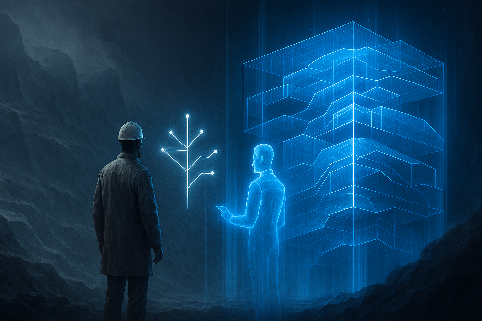
The future AI prospector is not a red cross on a map
The most useful misconception to remove is the cartoon version of AI exploration: feed in maps, get a location, send robots, discover copper. Charming, in the way lottery tickets are charming.
Caers argues for the opposite. AI should enhance domain experts by doing what humans are bad at: reading large bodies of documents quickly, detecting high-dimensional patterns, avoiding some cognitive biases, quantifying uncertainty realistically, and supporting decisions under uncertainty.
Humans remain essential where process-based geological thinking matters: forming conceptual hypotheses, interpreting time-space relationships, understanding mineral-system logic, and judging geological plausibility. The future workflow is not “AI versus geologist.” It is geologist plus AI plus explicit uncertainty.
This is especially important for hypothesis generation. Geologists often work with familiar low-dimensional relationships: for example, known bivariate geochemical plots or expected spatial associations. AI can search higher-dimensional geological, geochemical, geophysical, and spatial patterns that humans may not easily see. But the output must still become a falsifiable geological hypothesis, not a decorative anomaly cluster.
A useful AI system for exploration should therefore support four tasks:
| AI role | What it should do | Why it matters |
|---|---|---|
| Knowledge retrieval | Search reports, papers, historic maps, and databases | Preserves old geological knowledge and reduces repetitive manual review |
| Pattern discovery | Detect anomalies and relationships in high-dimensional data | Expands the hypothesis space beyond familiar plots |
| Stochastic modeling | Generate uncertainty-aware subsurface scenarios | Prevents single-model overconfidence |
| Sequential planning | Recommend next surveys or drill holes based on uncertainty reduction | Connects analysis to capital allocation |
Notice what is missing: “predict the exact mine location.” That is the brochure version. The decision-science version is less glamorous and more useful.
The key economic object is information, not ore
Exploration companies ultimately care about ore, grade, tonnage, and economics. But early in the process, the immediate object being purchased is information.
A drill hole is a measurement. A geophysical survey is a measurement. A soil campaign is a measurement. The business question is not simply “will this activity find mineralization?” It is: how much will this activity reduce uncertainty about the decision we need to make?
Caers invokes efficacy of information as a metric for this logic. The paper describes it as a way to quantify how much future data will reduce uncertainty, on average, about a quantity of interest. That quantity may change across the exploration sequence. Early drilling may be best used to discriminate among geological hypotheses. Later drilling may target volume. Later still, it may focus on grade and grade-tonnage relationships.
This hierarchy is one of the paper’s most business-relevant ideas:
drill for hypotheses → drill for volume → drill for grade
Traditional exploration often wants to hit mineralization quickly because a hit is easy to communicate to investors. But from a decision perspective, the best early hole may be the one that kills several bad hypotheses, not the one most likely to produce a press-release-friendly intercept.
That distinction is not academic. It changes incentives.
For a major mining company, the value lies in reducing wasted exploration budgets and improving portfolio prioritization. For a junior explorer, the problem is harder: the market may reward visible success more than epistemic discipline. For investors, the idea suggests a different financing model: fund portfolios of prospects and price uncertainty reduction across them, rather than betting one drill hole at a time. For software vendors, the opportunity is not another dashboard. It is a decision workflow that connects hypotheses, uncertainty, data acquisition, and financial value.
POMDPs and Monte Carlo tree search are planning tools, not magic acronyms
The paper’s AI-planning discussion uses concepts familiar from robotics and sequential decision-making: partially observable Markov decision processes, Monte Carlo tree search, online and offline planning, belief states, rewards, and actions.
The mining translation is straightforward.
The true subsurface is not fully observed. The exploration team has a belief about it. Each action—airborne geophysics, surface sampling, drilling—costs money and produces imperfect information. The team updates its belief and chooses the next action. The reward may be uncertainty reduction, expected economic value, hypothesis falsification, or some combination of geological and sustainability objectives.
A POMDP-style framing is useful because exploration is sequential. A single drill hole is not an isolated act; it affects what the next hole should be. Monte Carlo tree search is useful because the number of possible future paths can become large. The planning problem is not “which point on the map has the highest score?” It is “which sequence of measurements creates the best expected decision path under uncertainty?”
Caers points to the Mingomba deposit in Zambia as the most significant field-facing example of decision-making AI in mineral exploration. Historical drilling was re-analyzed, new hypotheses about a high-grade portion were generated, and AI formulated as a POMDP was used to sequentially plan drilling. The reported advantage was efficiency relative to traditional grid-based drilling because the method focused on reducing uncertainty over geological hypotheses rather than merely trying to intersect mineralization.
That should be read carefully. It is not proof that every exploration campaign should immediately deploy the same architecture. It is evidence that the planning frame can be operationalized in a real exploration context. The distinction matters. One is science; the other is procurement theater.
The business case is fewer expensive mistakes, not cheaper maps
The easiest way to undersell this paper is to describe it as “AI for mineral exploration.” That phrase is too broad to be useful. The business case is more specific: reduce false-positive drilling and improve capital allocation under uncertainty.
The pathway looks like this:
better data curation → better hypothesis space → stochastic uncertainty quantification → falsification-oriented data acquisition → fewer false positives → better exploration capital efficiency
For mining companies, this implies several operational changes.
First, exploration teams need to organize around decision problems rather than disciplines. Geologists, geophysicists, geochemists, data scientists, and decision analysts cannot simply pass outputs down a pipeline. The Popper-Bayes protocol requires them to build and test shared hypotheses.
Second, uncertainty must become a management object. In many organizations, uncertainty is treated as a weakness in the analyst. Caers is blunt about the cultural problem: companies socialize around single models, and those models gradually become treated as truth. A more serious exploration organization would ask every model to carry its uncertainty, assumptions, falsification conditions, and decision relevance.
Third, software must change. Much of today’s software is built for deterministic interpretation because that is what users know how to buy. Rigorous uncertainty quantification, Monte Carlo sampling, stochastic inversion, and planning under uncertainty require more computation and more specialized workflows. Small juniors may not be able to afford the cloud cost or expertise. That creates a market gap for shared platforms, managed decision-science services, or portfolio-level exploration infrastructure.
Fourth, financing needs redesign. The paper’s analogy to stock portfolios is apt. A one-prospect, one-hole financing cycle encourages short-term confirmation. A portfolio of prospects allows risk and return to be traded off across uncertainty distributions. That does not make geology easy. It simply makes the financial structure less hostile to rational learning.
Sustainability belongs inside the decision function, not after the discovery party
One valuable part of the paper is that sustainability is not pasted on as a ceremonial ESG paragraph. Caers argues that exploration decision-making should include social and environmental metrics early, preferably across a portfolio of prospects.
The mechanism is practical. Not every economic deposit should be mined if environmental and community impacts outweigh benefits. Higher-grade deposits may, in some cases, allow smaller physical footprints or different mining methods. The paper contrasts low-grade copper operations with high-grade underground mining as an example of why grade and size can affect environmental impact.
The important boundary is jurisdiction. Sustainability is not a universal scalar that can be optimized from a spreadsheet in San Francisco. It depends on federal, state, local, community, ecological, and regulatory contexts. But that is exactly why it should enter the decision framework early. If sustainability risk is only evaluated after resources become reserves, companies may discover that the technically attractive project is socially or legally fragile.
In Popper-Bayes terms, sustainability is not a press-release category. It is part of the reward function and the portfolio trade-off.
Knowledge retention may be the quiet AI use case
The paper’s final practical theme is knowledge retention. Mineral exploration depends on old reports, maps, survey records, field notes, government databases, and expert memory. Some of this knowledge sits in high-quality public databases. Some of it sits in forgotten reports. Some of it retires with the geologist.
LLMs and retrieval systems can help here, but only if used as infrastructure rather than novelty. The useful workflow is not “ask a chatbot where to drill.” It is: ingest historical geological knowledge, organize it into queryable evidence, connect it with modern geophysical and geochemical datasets, and expose it to hypothesis generation and falsification.
This is where AI can be boring in the best possible way. A system that prevents teams from rediscovering old knowledge, missing relevant analogues, or ignoring contradictory evidence may be more valuable than a flashy anomaly detector.
The opportunity is especially relevant where public geological databases are weak or fragmented. Better data access can attract investment, improve national mineral assessment, and lower the entry barrier for systematic exploration. But again, the paper’s logic is disciplined: knowledge retrieval only matters if it feeds better hypotheses and better decisions.
Where the paper is strong, and where businesses should be careful
The paper is strongest as a conceptual and operational synthesis. It connects Bayesian inversion, Popperian falsification, geostatistical scale issues, AI-assisted hypothesis generation, sequential planning, and financing structure into one coherent exploration argument.
It is not strongest as a quantified ROI study. It does not provide a controlled comparison across many exploration campaigns showing exactly how much AI-driven Popper-Bayes workflows reduce drilling cost. Nor does it offer a finished software architecture that a junior explorer can deploy next Monday. Anyone selling it that way should be gently escorted away from the budget meeting.
The main practical boundaries are clear:
| Boundary | Why it matters |
|---|---|
| Data quality varies sharply by region and company | AI cannot repair missing, biased, or poorly documented observations by enthusiasm alone |
| Stochastic modeling requires expertise | Bayesian workflows can become ritualistic if teams do not understand priors, likelihoods, and model checking |
| Computation has cost | Monte Carlo methods and stochastic inversion may require HPC or cloud resources beyond small-company budgets |
| Incentives are misaligned | Junior explorers may be rewarded for visible “hits,” not for falsifying weak hypotheses |
| Sustainability is local | Environmental and social trade-offs must be jurisdiction-specific, not abstract ESG decoration |
| Evidence is partly illustrative | The paper is an expert essay with field examples, not a universal benchmark suite |
These boundaries do not weaken the argument. They make it usable. The point is not that AI will automatically fix mineral exploration. The point is that AI only becomes valuable when embedded in a decision method that punishes false confidence.
The overdue upgrade is scientific discipline
Caers’ paper is really about organizational epistemology, though that phrase would look terrible on a mining conference banner.
The industry’s old workflow made sense when surface clues were stronger and deposits were easier to find. Under cover, indirect evidence dominates. The cost of being wrong rises. The need to reason explicitly about uncertainty becomes unavoidable.
AI enters this story not as the heroic prospector but as the machinery that makes a stricter method practical. It can help read more evidence, search larger pattern spaces, generate more hypotheses, simulate more plausible subsurface models, and plan more rational data acquisition. But the intellectual control remains with a disciplined exploration process: hypotheses first, falsification next, uncertainty always.
That is the real business message. The future of AI in critical minerals is not a red cross on a map. It is a workflow that makes teams ask, before spending millions: what exactly do we believe, what would prove us wrong, and what data is worth buying next?
For an industry where drilling is expensive and certainty is often theatrical, that may be the most useful kind of intelligence.
Cognaptus: Automate the Present, Incubate the Future.
-
Jef Caers, “The future of AI in critical mineral exploration,” arXiv:2512.02879, https://arxiv.org/pdf/2512.02879. ↩︎